Hiking on the Costa Tropical
Sea cliffs, sugar-cane heritage, the Guadalfeo delta and the hills above Motril: low-altitude walking with the sea in view.
✓ Facts checked on 8 November 2026

All routes with published figures
Figures are copied from Motril Turismo, Turismo de Salobreña and the Junta de Andalucía. These sources do not publish start coordinates, so we show no map rather than guessing.
Comparison of trails with official data
| Trail | Area | Route type | Distance | Time (official) | Altitude / Elevation | Difficulty |
|---|---|---|---|---|---|---|
| Acantilados de Sacratif | Motril | – | 2.4 km | 40 min * | 9–55 m | Medium-low |
| La Defensa Costera | Motril | – | 7 km | 1 h 26 min | 0–22 m | Easy |
| Las Lagunas | Motril | Loop | 2 km | 30 min | 0–4 m | Easy |
| El Maraute | Motril | Loop | 3.8 km | 49 min | 19–97 m | Easy |
| Vega de Motril | Motril | Loop | 6.6 km | 1 h 20 min | 1–40 m | Easy |
| Fábricas Azucareras | Motril | Loop | 2.3 km | 28 min * | 28–44 m | Easy |
| Cultivos Subtropicales | Motril | – | 5.2 km | 1 h 05 min * | 26–48 m | Easy |
| Ruta Vega Baja de Salobreña y Motril | Salobreña | Loop | 19.3 km | 5 h | 10–25 m | Easy |
| Azud de los Vados | Motril | Loop | 4.8 km | 1 h 02 min * | 59–124 m | Easy |
| Rambla Cañizares | Motril | – | 2.8 km | 45 min * | 73–124 m | Easy |
| Cumbre del Cerro Gordo (Motril) | Motril | – | 2.6 km | 1 h | 211–499 m | Medium-high |
| Camino Antiguo de Granada | Motril | – | 3.5 km | 1 h 04 min | 206–363 m | Easy |
| Fuente de la Bullarenga | Motril | Loop | 7.5 km | 1 h 38 min | 288–459 m | Medium |
| Garnatilla – Alcántara | Motril | – | 10.4 km | 2 h 46 min * | 289–722 m | Medium |
| Sierra del Conjuro | Motril | – | 8.8 km | 2 h * | 482–658 m | Medium-low |
| Senda Mediterránea Salobreña – Almuñécar | Salobreña | Linear (one way) | 14.54 km | 4 h | 1–82 m | Easy |
| Sendero Sierra del Chaparral | Costa Tropical | – | 7.9 km | 2 h 40 min | 255–558 m | Medium |
* Official time for the return walk (“ida y vuelta”).
Along the sea: cliffs, coastal defences and wetlands
East of Motril, the coast is lined with cliffs and old coastal defences. These short, low routes need no special fitness, but cliff edges and road crossings call for attention.

Motril · Official data
Acantilados de Sacratif
From the eastern end of the Torrenueva Costa promenade along the cliff edge to the cove of La Joya, ending at a car park beside the N-340; a short detour leads to the Sacratif lighthouse. Steep rocky slopes with seabirds.
- Distance
- 2.4 km · Official time for the return walk (“ida y vuelta”).
- Time (official)
- 40 min
- Altitude
- 9–55 m
- Difficulty
- Official grade (Motril tourism): medium-low.
- Terrain
- Mostly path, some dirt and asphalt.
Source: Motril Turismo · Acantilados de Sacratif · Checked 2026-11-08
Motril · Official data
La Defensa Costera
A coastal-heritage walk from the car park opposite the Carchuna castle, on the defences built after the conquest of Granada in 1492 moved the frontier to the coast; it ends by the “Cueva del Bigotes”, across the N-340.

- Distance
- 7 km
- Time (official)
- 1 h 26 min
- Altitude
- 0–22 m
- Difficulty
- Official grade (Motril tourism): low.
- Terrain
- Pavement and asphalt, then sandy beach.
- Crosses the N-340.
Source: Motril Turismo · La Defensa Costera · Checked 2026-11-08
Motril · Official data
Las Lagunas
A short, flat loop by the Playa de Poniente, next to the Gran Hotel Elba Motril, around a wetland protected as a Reserva Natural Concertada.
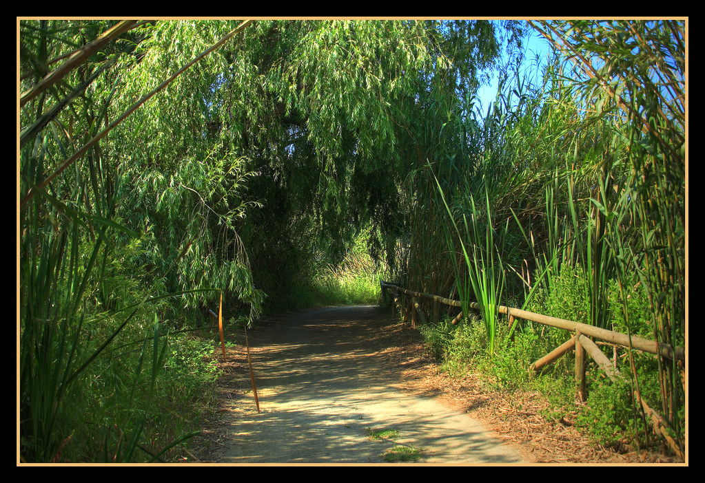
- Route type
- Loop
- Distance
- 2 km
- Time (official)
- 30 min
- Altitude
- 0–4 m
- Difficulty
- Official grade (Motril tourism): low.
- Terrain
- Firm path, muddy in some seasons.
Source: Motril Turismo · Las Lagunas · Checked 2026-11-08
Motril · Official data
El Maraute
A loop starting on the Camino de la Cañada Vargas, near the Torrenueva Costa cemetery.
- Route type
- Loop
- Distance
- 3.8 km
- Time (official)
- 49 min
- Altitude
- 19–97 m
- Difficulty
- Official grade (Motril tourism): low.
- Terrain
- Asphalt and dirt track.
Source: Motril Turismo · El Maraute · Checked 2026-11-08
The plain: sugar heritage and subtropical orchards
The Guadalfeo delta forms the Motril–Salobreña plain, once covered in sugar cane. Flat routes link former sugar factories, orchards of subtropical fruit and the farmland between the two towns.
Motril · Official data
Vega de Motril
A loop from the tourist office, north of the Parque de los Pueblos de América, through the Motril–Salobreña plain formed by the Guadalfeo delta (about 35 km²).
- Route type
- Loop
- Distance
- 6.6 km
- Time (official)
- 1 h 20 min
- Altitude
- 1–40 m
- Difficulty
- Official grade (Motril tourism): low.
- Terrain
- Asphalt, dirt track and good path.
Source: Motril Turismo · Vega de Motril · Checked 2026-11-08
Motril · Official data
Fábricas Azucareras
Sugar-industry heritage: from the Fábrica Azucarera del Pilar, about 300 m north of the Motril ring road, to the Almudena house and back by another path.
- Route type
- Loop
- Distance
- 2.3 km · Official time for the return walk (“ida y vuelta”).
- Time (official)
- 28 min
- Altitude
- 28–44 m
- Difficulty
- Official grade (Motril tourism): low.
- Terrain
- Asphalt and pavement.
Source: Motril Turismo · Fábricas azucareras · Checked 2026-11-08
Motril · Official data
Cultivos Subtropicales
Through subtropical orchards from the Fábrica de Nuestra Señora de la Almudena to the Cortijo de Los Bates; it connects with the sugar-factories route.
- Distance
- 5.2 km · Official time for the return walk (“ida y vuelta”).
- Time (official)
- 1 h 05 min
- Altitude
- 26–48 m
- Difficulty
- Official grade (Motril tourism): low.
- Terrain
- Asphalt.
Source: Motril Turismo · Cultivos subtropicales · Checked 2026-11-08
Salobreña · Official data
Ruta Vega Baja de Salobreña y Motril
A long, flat loop through the farmland of the lower Guadalfeo plain between Salobreña and Motril, from the tourist office in Salobreña.
- Route type
- Loop
- Distance
- 19.3 km
- Time (official)
- 5 h
- Altitude
- 10–25 m
- Difficulty
- Official grade (Turismo de Salobreña): low.
- Start
- Plaza de Goya (tourist office), Salobreña
- Season
- All year; in summer, early morning or at sunset (source).
Source: Turismo de Salobreña · Walking trails in Salobreña · Checked 2026-11-08
The Guadalfeo gorge from the Motril side
Two Motril routes lead towards the Tajo de los Vados, the canyon the Guadalfeo has cut between the coast and Vélez de Benaudalla. The Azud de los Vados route ends at a viewpoint over the gorge: the walkers’ way to see it. The canyon itself is a caving area, described in our guide to hiking in Vélez de Benaudalla.
Motril · Official data
Azud de los Vados
From the main road opposite the Azud de Lobres weir, along farm tracks and through pine woods to a viewpoint over the Guadalfeo gorge, the Tajo de los Vados, with panels on the young Motril plain and the canyon’s geology. The source calls it circular.
- Route type
- Loop
- Distance
- 4.8 km · Official time for the return walk (“ida y vuelta”).
- Time (official)
- 1 h 02 min
- Altitude
- 59–124 m
- Difficulty
- Official grade (Motril tourism): low.
- Terrain
- Mostly asphalt track, some dirt.
Source: Motril Turismo · Azud de los Vados · Checked 2026-11-08
Motril · Official data
Rambla Cañizares
Up the stony bed of a seasonal Mediterranean stream from near the Azud de Lobres weir, with panels on karst, the fauna of ramblas and the vegetation of the gorge. Floods are possible in the rainy season.
- Distance
- 2.8 km · Official time for the return walk (“ida y vuelta”).
- Time (official)
- 45 min
- Altitude
- 73–124 m
- Difficulty
- Official grade (Motril tourism): low.
- Terrain
- Stony riverbed.
- Do not walk the rambla during or after heavy rain: it can flood.
Source: Motril Turismo · Rambla Cañizares · Checked 2026-11-08
The hills above Motril
Behind the coast, routes climb Cerro Gordo and the pine-covered hills towards Lújar and Gualchos, with views over the delta and the Carchuna plain. Cerro Gordo’s summit route is the steepest in Motril’s list (graded medium-high).
Motril · Official data
Cumbre del Cerro Gordo (Motril)
A short, steep climb up the southern side of Cerro Gordo, the hill above Motril, to a ruined hut on the summit with wide views. Not to be confused with the Cerro Gordo cliffs at La Herradura.
- Distance
- 2.6 km
- Time (official)
- 1 h
- Altitude
- 211–499 m
- Difficulty
- Official grade (Motril tourism): medium-high.
- Terrain
- Stony path.
Source: Motril Turismo · Cumbre del Cerro Gordo · Checked 2026-11-08
Motril · Official data
Camino Antiguo de Granada
From the Parque Periurbano del Mirador, an unpaved track climbs the slope of Cerro Gordo (Motril) to the line of the old road to Granada on its eastern side.
- Distance
- 3.5 km
- Time (official)
- 1 h 04 min
- Altitude
- 206–363 m
- Difficulty
- Official grade (Motril tourism): low.
- Terrain
- Earth and stony path.
Source: Motril Turismo · Camino Antiguo de Granada · Checked 2026-11-08
Motril · Official data
Fuente de la Bullarenga
A loop on dirt tracks starting at km 3 of the road to Lagos, opposite the turning to La Gorgoracha.
- Route type
- Loop
- Distance
- 7.5 km
- Time (official)
- 1 h 38 min
- Altitude
- 288–459 m
- Difficulty
- Official grade (Motril tourism): medium.
- Terrain
- Dirt track.
Source: Motril Turismo · Fuente de la Bullarenga · Checked 2026-11-08
Motril · Official data
Garnatilla – Alcántara
From the hamlet of La Garnatilla through pine and carob woodland, past the 19th-century Cortijo Burgos and its aqueduct and the derelict Cortijo de Alcántara, to near the La Pingana watch post, with views over the Guadalfeo delta. A path links to the Sierra del Conjuro route.
- Distance
- 10.4 km · Official time for the return walk (“ida y vuelta”).
- Time (official)
- 2 h 46 min
- Altitude
- 289–722 m
- Difficulty
- Official grade (Motril tourism): medium.
- Terrain
- Paved road, then forest tracks.
Source: Motril Turismo · Garnatilla-Alcántara · Checked 2026-11-08
Motril · Official data
Sierra del Conjuro
From the Gualchos–Lújar road, about 1 km before Fuente del Moral, through Mediterranean scrub and pine plantations past an abandoned almond orchard to the Cortijo de Alcántara, with a viewpoint over the Carchuna plain.
- Distance
- 8.8 km · Official time for the return walk (“ida y vuelta”).
- Time (official)
- 2 h
- Altitude
- 482–658 m
- Difficulty
- Official grade (Motril tourism): medium-low.
- Terrain
- Dirt track.
Source: Motril Turismo · Sierra del Conjuro · Checked 2026-11-08
Salobreña, the Sierra del Chaparral and the Cerro Gordo cliffs
West of the Guadalfeo, Salobreña publishes a coastal path to Almuñécar and a loop to its cliffs; the Junta de Andalucía publishes the Sierra del Chaparral trail above Molvízar and a loop to the Cerro Gordo watchtower in the Maro–Cerro Gordo cliffs natural area, not the same Cerro Gordo as the hill above Motril.

Salobreña · Official data
Senda Mediterránea Salobreña – Almuñécar
A linear coastal walk between Salobreña and Almuñécar; the source recommends returning by bus.
- Route type
- Linear (one way)
- Distance
- 14.54 km · One way.
- Time (official)
- 4 h
- Altitude
- 1–82 m
- Difficulty
- Official grade (Turismo de Salobreña): low.
- Start
- Salobreña
- Finish
- Almuñécar
Source: Turismo de Salobreña · Walking trails in Salobreña · Checked 2026-11-08
Salobreña · Conflicting sources
Ruta Acantilados y Monte Almendros
A loop from Salobreña to the Chaparral cliffs and small coves and up to Monte Almendros.
- Route type
- Loop
- Distance
- 13.76 km
- Time (official)
- 4 h
- Altitude
- 10–561 m
- Difficulty
- Published as “low”, inconsistent with the published altitudes.
- The coves are visited depending on sea conditions (source).
Source: Turismo de Salobreña · Walking trails in Salobreña · Checked 2026-11-08
Costa Tropical · Official data
Sendero Sierra del Chaparral
Official trail in the limestone Sierra del Chaparral above Molvízar, with dense scrub since a past fire, dry-stone walls and rock trenches.
- Distance
- 7.9 km
- Time (official)
- 2 h 40 min
- Elevation
- 303 m between lowest and highest point
- Altitude
- 255–558 m
- Difficulty
- Official grade: medium.
- Start
- Molvízar
- Terrain
- Path and track.
- Shade
- None
- Permit
- Not required
- Some sections have a risk of falls; keep out of ravines during storms; avoid days of extreme heat. Vehicle access through the village is not recommended (narrow streets).
Source: Junta de Andalucía · Sendero Sierra del Chaparral · Checked 2026-11-08
Costa Tropical · Route description
Sendero Torre de Cerro Gordo
A small official loop to the Cerro Gordo watchtower in the Maro–Cerro Gordo Cliffs Natural Area, with views towards Salobreña and Torrox Costa; after the tower the path becomes steeper and harder, with cliffs on the right, and returns through pine woods. Wild goats may be seen.
- Route type
- Loop
- Difficulty
- Official grade: medium.
- Terrain
- Thin, eroded soils with pine and scrub; rougher after the tower.
The figures in the official online sheet are unreadable; not reproduced.
- Cliff edges after the tower: keep away from the drop.
Source: Junta de Andalucía · Sendero Torre de Cerro Gordo · Checked 2026-11-08
Heat, shade and timing
Summer
Salobreña’s tourist office recommends walking early in the morning or at sunset in summer. Many routes have little or no shade.
Ramblas
Dry stream beds can flood after heavy rain: avoid them during and after storms.
Cliffs and roads
Keep away from cliff edges; several routes cross or end at the N-340.
Emergencies
Call 112.
Between the coast and the mountains
Rincón Salvaje is in Vélez de Benaudalla, in the Guadalfeo valley between the Costa Tropical and the Alpujarra. Coastal routes are reached by car; the village’s own routes start on foot from the main square.
Frequently asked questions
Are there official hiking routes in Motril?
Yes. Motril’s tourism office publishes 14 routes with distance, estimated time, minimum and maximum altitude and difficulty, from the Sacratif cliffs to the Sierra del Conjuro.
What is the hardest hike around Motril?
In Motril’s own list, the Cumbre del Cerro Gordo is graded medium-high: 2.6 km and 1 hour, climbing from 211 m to 499 m. The longest is Garnatilla–Alcántara, 10.4 km between 289 and 722 m.
Can I see the Tajo de los Vados on foot?
Yes: Motril’s Azud de los Vados route (4.8 km, graded low) ends at a viewpoint over the gorge. The canyon itself is a caving area, not a trail.
Is there a coastal walk from Salobreña to Almuñécar?
Yes. Salobreña’s tourist office publishes a 14.54 km linear route of about 4 hours one way, graded low, and recommends returning by bus.
When is it too hot to hike on the Costa Tropical?
In summer, walk early in the morning or at sunset, as Salobreña’s tourist office advises, and carry plenty of water; many routes have little shade.
Sources · Facts checked on 8 November 2026
- Motril Turismo · Senderismo (14 routes)
- Motril Turismo · Acantilados de Sacratif
- Motril Turismo · Azud de los Vados
- Motril Turismo · Cumbre del Cerro Gordo
- Motril Turismo · Garnatilla-Alcántara
- Motril Turismo · Sierra del Conjuro
- Turismo de Salobreña · Walking trails in Salobreña
- Junta de Andalucía · Sendero Sierra del Chaparral
- Junta de Andalucía · Sendero Torre de Cerro Gordo
- Ayuntamiento de Vélez de Benaudalla · El Tajo de los Vados


